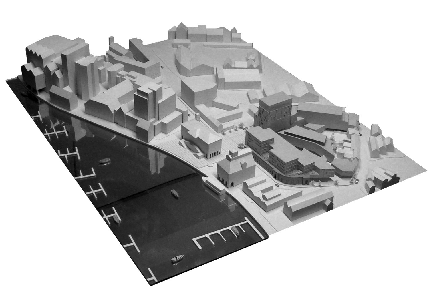
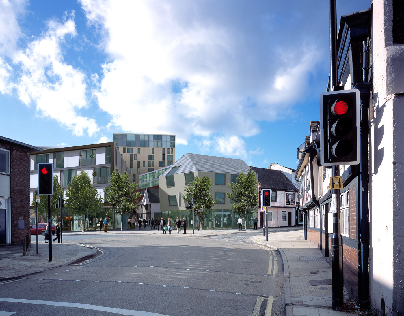
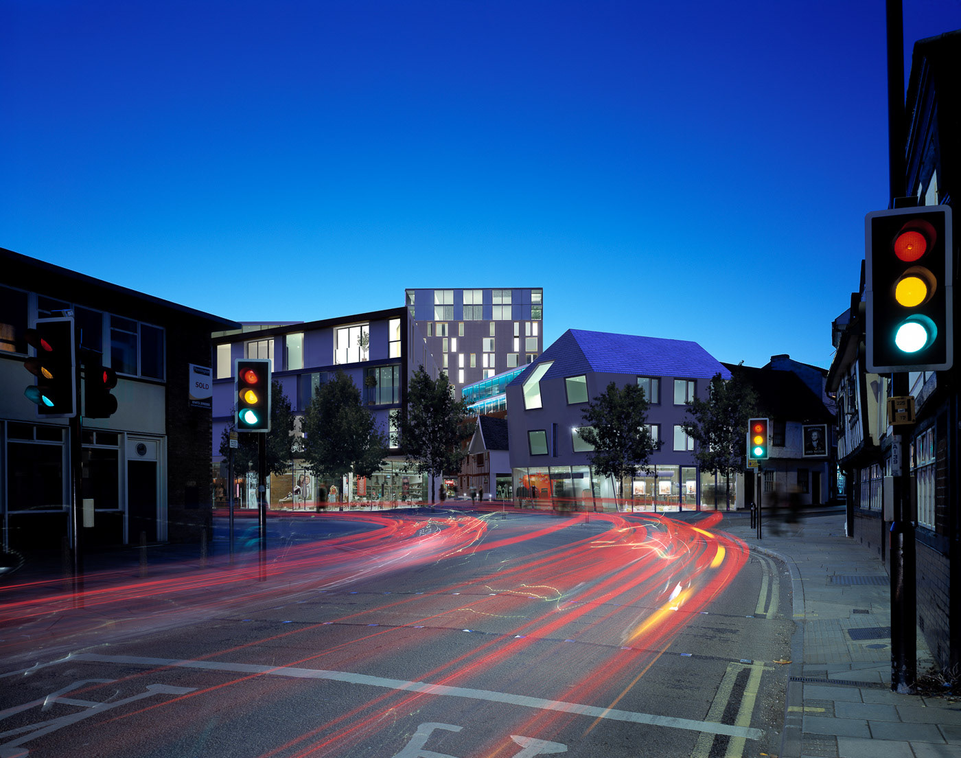
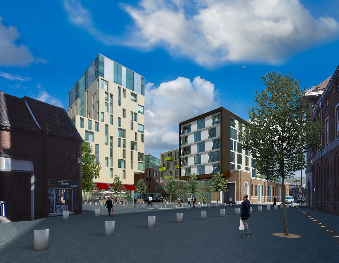
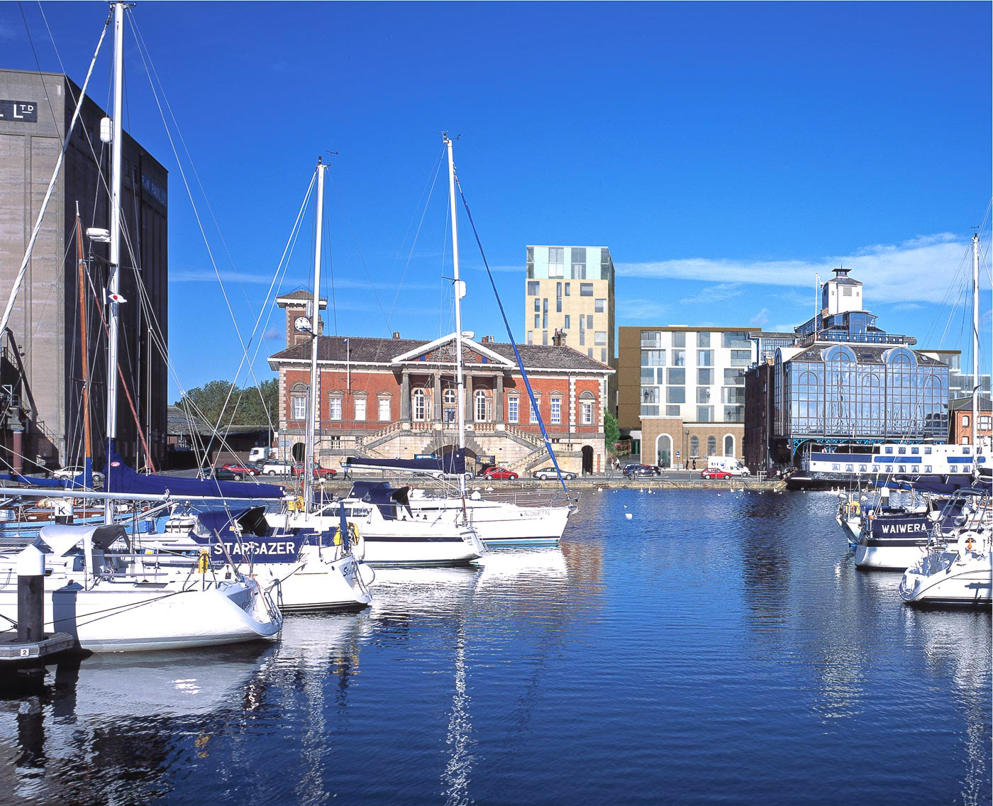
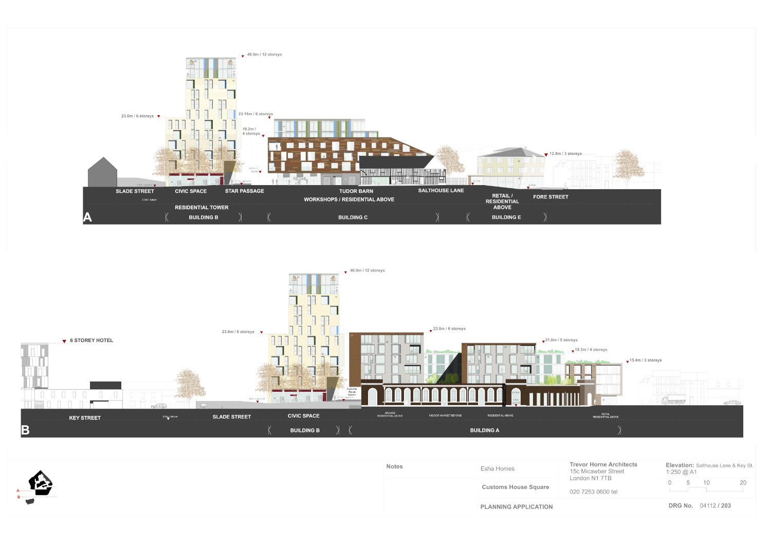
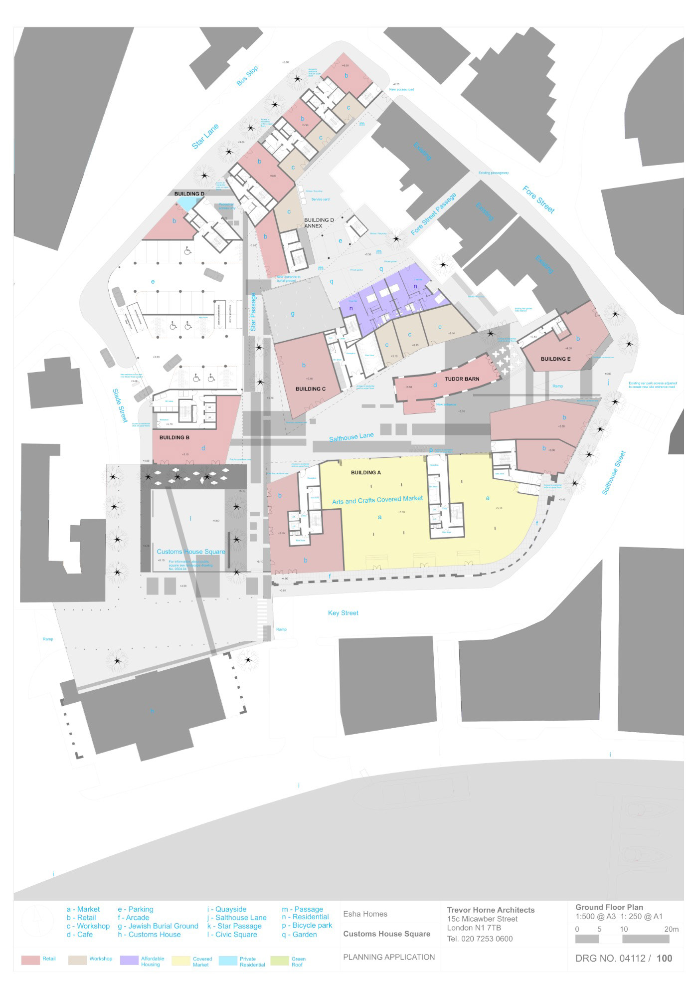


Positioned between the Ipswich Quay and the only remaining Medieval Port area in Britain our scheme connects this stranded island to the old Town. A public route lined with a mix of buildings – hotels, apartments, shops, Medieval buildings, new buildings, converted building - traverses the site. This route connects to a tree-lined public square addressing the Old Customs House also bordered by restaurants and shops. A 14 storey residential tower is a marker for the square having views of the waterside. By respecting the history of the site – tracing ancient pathways, place making for the Jewish Burial Ground, remodelling the listed 1930 John + Slater buildings, upgrading the Grade 1 listed Tudor barn for public use – the past forms a structure for the future. Residential Units: 211 Retail & Workshops: 3000sqm Parking Spaces: 198